Download pdf versions: English Français and Español
El Niño and La Niña cycle has impacts all over the globe. For example, El Niño years are one factor that can increase the risk of colder winters in the United kingdom. We now much understand these effects and reproduce many of them in our climate models. In Short, El Niño and La Niña are terms which describes the largest fluctuation in the ‘Earth’s climate system’ and can have consequences across the universe. La Niña’ is the term adopted for the opposite side of the fluctuation, which sees episodes of cooler-than-normal sea surface temperature in the equatorial Pacific.
The fluctuation sees changes in the sea-surface temperature of the ‘tropical Pacific Ocean’ which occur every few years. Meanwhile, Since the 1930s, as a result of the pioneering work of Gilbert Walker, climate scientists know ‘El Niño’ occurs at the same time with the Southern Oscillation, which is a change in air pressure over the tropical Pacific Ocean. It is an oscillation of the ocean-atmosphere system in the tropical Pacific which impacts weather patterns. It’s also known as the El Niño-Southern Oscillation (ENSO) cycle.
Current Situation and Outlook
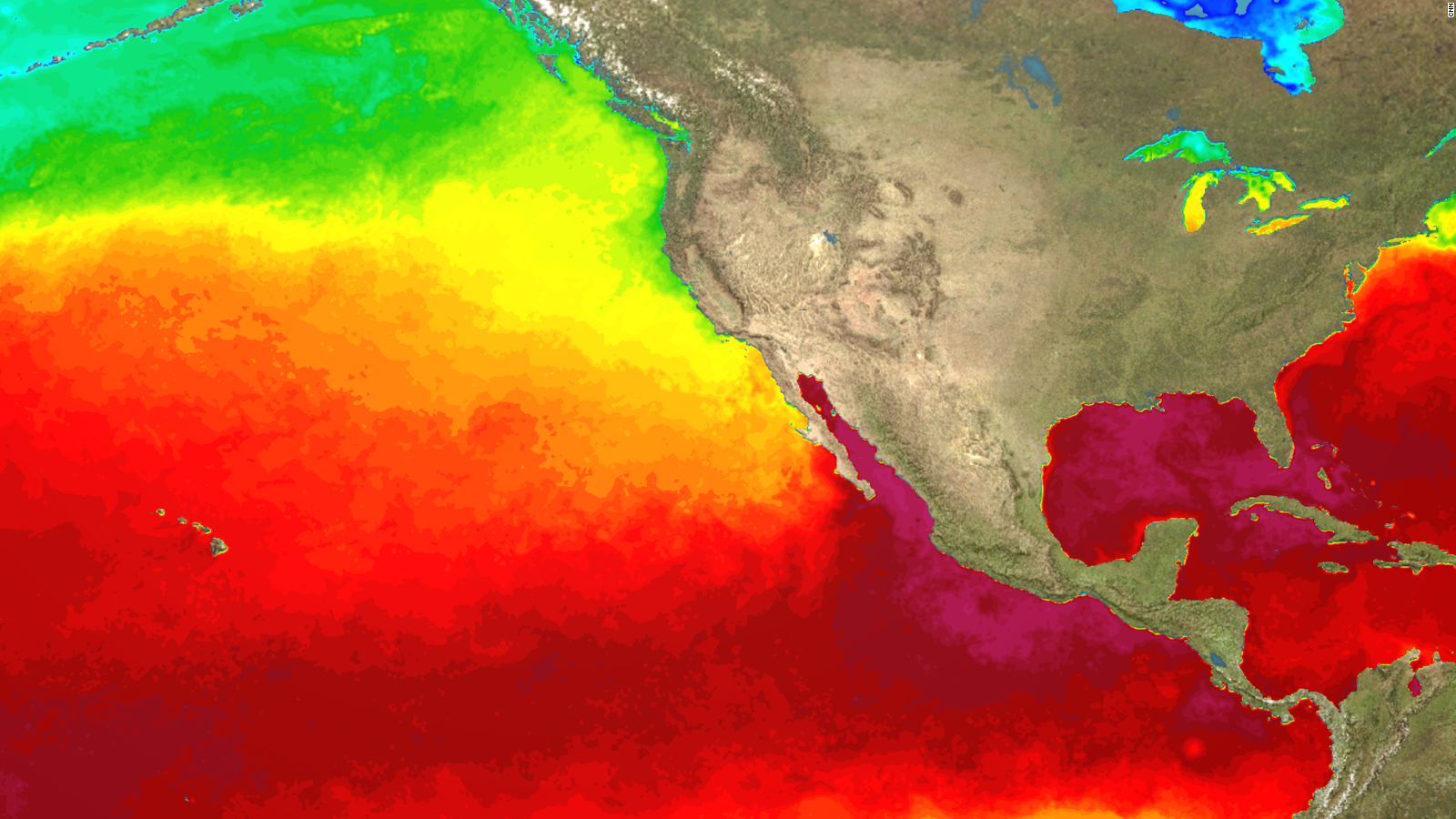
Sea surface temperatures in the east-central tropical Pacific as well as most of the overlying atmospheric indicators show that ENSO-neutral conditions (neither El Niño nor La Niña) continue to prevail. However, most dynamical and statistical forecast models suggest an imminent warming of the tropical Pacific, reaching a weak El Niño level by the fourth quarter of the year. The chance of El Niño is about 70%, with uncertain strength, as model predictions range from ENSO-neutral to a moderate strength El Niño. National Meteorological and Hydrological Services will continue to closely monitor changes in the state of ENSO over the coming months.
— WMO | OMM (@WMO) September 10, 2018
Since April 2018, sea surface temperatures across the east-central tropical Pacific have been at neutral levels, and the atmospheric indicators of the ENSO state have also suggested mainly neutral conditions. For example, upper level winds, cloudiness patterns and sea level pressure patterns continue to reflect neutral conditions. During the last several weeks, however, low-level winds in the west tropical Pacific Ocean have been anomalously westerly, which is an indicator of the possible coming onset of El Niño conditions.
The temperature of the waters at depth, from the central Pacific eastward and extending several hundred meters below the surface, have been moderately above average since April 2018. The waters at depth often provide an indication of the coming ENSO conditions at the surface, and suggest that the currently neutral sea surface temperatures may warm during September and into the fourth quarter of 2018, possibly reaching El Niño levels by the fourth quarter. The above-average water below the surface already extends to the surface in parts of the east-central tropical Pacific, causing warming of the sea surface, although not yet sufficiently to reach the El Niño threshold.
About three-quarters of the models surveyed predict that sea surface temperatures in the east-central tropical Pacific Ocean will warm to weak El Niño levels beginning late in the third or the fourth quarter of 2018. The time frame of this warming includes the immediate upcoming period of September-November. There is some uncertainty in these model predictions, as indicated by the forecasts ranging from a lack of an El Niño to a moderately strong El Niño event. The average prediction is for sea surface temperatures in the east-central tropical Pacific to warm to approximately 0.6 to 1.2 degrees Celsius above average during the period November 2018 through January 2019.
Based on the model predictions and expert assessment, the probability for the development of El Niño is considered to be about 70% for September through the end of 2018 and into early 2019. This probability implies that El Niño development is more than twice as likely as a continuation of neutral conditions through the end of this period. If El Niño does emerge, its strength is currently uncertain but a strong event appears unlikely.
It is important to note that El Niño and La Niña are not the only factors that drive global climate patterns, and that the strength of ENSO does not automatically correspond to the strength of its effects. At the regional level, seasonal outlooks need to take into account the relative effects of both the El Niño/Southern Oscillation state and other locally relevant climate drivers.
For example, sea surface temperatures of the Indian Ocean, the southeastern Pacific Ocean and the Tropical Atlantic Ocean are also known to influence the climate in the adjacent land areas. Regionally and locally applicable information is available via regional and national seasonal climate outlooks, such as those produced by WMO Regional Climate Centres (RCCs), Regional Climate Outlook Forums (RCOFs) and National Meteorological and Hydrological Services (NMHSs).
In summary:
- Conditions in the ocean and atmosphere in the tropical Pacific have remained neutral since April 2018;
- Model predictions and expert opinion indicate that El Niño/Southern Oscillation conditions are about 70% likely to reach weak El Niño levels by the fourth quarter of 2018 and into the Northern Hemisphere winter 2018-19;
- While predictions of El Niño and La Niña have relatively high confidence at this time of the year, some uncertainty is reflected by the broad range of model forecasts currently available, which generally indicate the sea surface temperatures to be 0.6 to 1.2 degrees Celsius above average in the east-central topical Pacific during the period of November 2018 through January 2019. A strong El Niño event appears unlikely.
- Through Northern Hemisphere winter 2018-19, the development of La Niña can be practically ruled out.
The state of ENSO will continue to be carefully monitored. More detailed interpretations of regional climate variability will be generated routinely by the climate forecasting community over the coming months and will be made available through National Meteorological and Hydrological Services.


